DMT7: Spatializing Data // 05.06.14 @ ENSCI
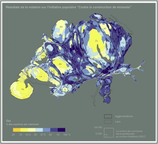
[img: Lévy & Chavanier, A Cartogramme: Switzerland: Referendum on Minarets, 2009] In addition to the problem of how to graphically treat and visualize data (dealt with in the previous session), are a series of underlying questions about the metaphors, metonyms and metrics we deploy to translate the digital into the spatial (Levy, 2012). When we invoke digital “mapping” tools, or talk about “spatializing” our networks through tools such as Gephi, we are making loose references to practices and techniques of the field of cartography. The session will unpack the relationship between web cartography and traditional cartography by taking a long […]
